
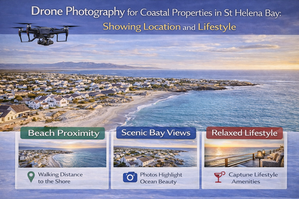
Drone Photography for Coastal Properties in St Helena Bay: Showing Location and Lifestyle
Coastal property marketing operates under a different set of rules to inland real estate. Buyers are not only evaluating a structure, a floor plan, or a price point. They are evaluating context. They want to understand how a property sits within its environment, how it connects to the coastline, and how it supports a particular way of living.
In St Helena Bay, this distinction is especially important. The area’s appeal lies as much in its geography, openness, and rhythm of life as it does in individual homes. Drone photography has become one of the most effective tools for communicating this broader value, not because it is visually impressive, but because it solves a fundamental marketing problem: showing location and lifestyle clearly, honestly, and efficiently.
This article analyses how drone photography improves coastal property marketing in St Helena Bay by translating geography into understanding, lifestyle into imagery, and location into emotional relevance for buyers, particularly those viewing remotely.
The Core Challenge in Coastal Property Marketing
Coastal properties are rarely judged in isolation.
Buyers compare how close homes are to the water, how open the surroundings feel, how neighbourhoods are structured, and how daily life might unfold beyond the front door. Traditional ground-level photography struggles to communicate these factors.
From inside a room or a garden, it is difficult to show:
• Relationship to the shoreline
• Spacing between neighbouring properties
• Orientation to light and wind
• Openness of the surrounding area
• Overall coastal character
When this context is missing, buyers are forced to imagine it. Imagination introduces uncertainty, and uncertainty slows decisions.
Drone photography addresses this gap directly.
Coastal Geography and Layout as Value Drivers
St Helena Bay’s geography is a core part of its value proposition.
The area is characterised by gentle coastal curves, open residential layouts, and a strong relationship between homes and the surrounding landscape. Unlike dense urban coastal strips, St Helena Bay offers a sense of space and visual breathing room.
Drone photography allows this geography to be understood quickly.
From an aerial perspective, buyers can see how properties relate to the bay, how streets are laid out, where open spaces exist, and how the area flows as a whole. This information is difficult to convey through text or interior images alone.
In coastal markets, geography is not background information. It is part of the product.
Why Ground-Level Photos Are Not Enough
Ground-level photography is essential for showing interiors and finishes, but it is inherently limited.
It shows fragments rather than systems.
A patio may look appealing, but without aerial context, buyers do not know whether it faces open space, another home, or a road. A window may suggest light, but its orientation remains unclear.
Drone photography fills these gaps by providing spatial context.
It answers questions buyers may not consciously ask but instinctively consider:
Where is this home in relation to the coast
How close are neighbouring houses
Does the area feel open or enclosed
By answering these questions visually, drone imagery reduces friction in the decision-making process.
Lifestyle Storytelling Through Aerial Imagery
Lifestyle marketing is not about exaggeration. It is about alignment.
Buyers drawn to St Helena Bay are often seeking a specific pace of life. They are interested in openness, coastal air, views, and a sense of separation from dense urban living. Drone photography supports lifestyle storytelling by showing how a property fits into that rhythm.
Aerial imagery can demonstrate:
• Proximity to the shoreline
• Access to walking routes or open areas
• Spatial calm of the neighbourhood
• Relationship between homes and landscape
These elements combine to tell a story without words.
Rather than claiming a “coastal lifestyle,” drone photos show it.
Showing the Bigger Picture Without Overstatement
One of the strengths of drone photography is neutrality.
When executed professionally, it does not embellish. It observes.
This observational quality is important in coastal property marketing. Buyers are cautious of over-promising visuals that do not align with reality. Aerial imagery that shows genuine context builds trust rather than suspicion.
In St Helena Bay, where authenticity is part of the appeal, understated aerial photography often outperforms dramatic cinematic approaches.
Buyers respond positively to imagery that feels honest and informative.
Attracting Out-of-Town and Relocating Buyers
A significant portion of interest in St Helena Bay comes from outside the immediate area.
Relocating buyers, semigrators, and retirees often begin their search remotely. They rely heavily on online listings to narrow options before committing to travel.
For these buyers, drone photography is especially valuable.
It allows them to understand:
• The character of the area
• How properties are positioned
• Whether the environment matches expectations
Without aerial context, out-of-town buyers may struggle to differentiate between listings. They may postpone engagement or focus on areas where context is clearer.
Drone imagery reduces this barrier by making location legible from afar.
Reducing Uncertainty for Remote Buyers
Remote buyers carry more perceived risk.
They worry about arriving to find that surroundings do not match expectations. They are cautious about committing time and resources without sufficient information.
Drone photography reduces this risk by showing what surrounds the property, not just the property itself.
When buyers feel that the listing has been transparent about context, they approach viewings with more confidence and less scepticism.
This confidence often translates into more decisive behaviour.
Emotional Impact of Location Visuals
While clarity is essential, emotion still plays a role.
Location visuals trigger emotional responses that interior photos often cannot. Seeing the curve of the bay, the openness of the landscape, or the spacing between homes helps buyers imagine daily life.
These emotional cues are subtle but powerful.
They influence how buyers perceive value, how attached they feel, and how motivated they become to act.
Drone photography connects emotion to reality by grounding feeling in visible context.
Buyer Psychology and Sense of Place
A strong sense of place supports faster decision-making.
When buyers can mentally place themselves within an environment, uncertainty decreases. They are no longer evaluating abstract features. They are imagining routines, views, and experiences.
Drone photography accelerates this process by giving buyers a mental map.
In St Helena Bay, where lifestyle alignment is often a deciding factor, this sense of place can be more influential than interior finishes alone.
Why Coastal Properties Benefit More Than Inland Homes
Inland properties often rely more heavily on interior condition, layout, and price.
Coastal properties add another dimension: surroundings.
Drone photography leverages this additional dimension effectively. It highlights what inland listings cannot easily replicate: openness, proximity, and relationship to natural features.
As a result, coastal listings tend to see a higher return on aerial imagery investment compared to purely inland homes.
Supporting Premium Positioning Through Context
Premium positioning is reinforced when buyers understand what makes a property distinct.
In St Helena Bay, distinction often comes from location rather than size. Aerial imagery shows that distinction clearly.
Properties that are well positioned relative to the bay, open areas, or favourable orientations benefit most. Drone photos make these advantages visible early, supporting asking price and reducing downward pressure in negotiations.
This does not inflate value artificially. It protects value by ensuring it is understood.
Drone Photography as a Filtering Tool
Not all buyers are suited to every location.
Drone imagery helps buyers self-select.
Those seeking dense, urban energy may realise quickly that St Helena Bay offers a different environment. Those seeking calm and space will recognise alignment.
This filtering improves enquiry quality and reduces wasted time for agents and sellers.
High-quality enquiries are often more valuable than high volume.
Avoiding Misalignment and Disappointment
One of the most common causes of buyer disappointment is misalignment between expectation and reality.
Drone photography reduces this risk by aligning expectations early. Buyers arrive informed rather than surprised.
This alignment improves viewing experiences and often leads to more productive conversations.
Professionalism and Execution Matter
Not all drone photography delivers these benefits.
Poorly planned aerial images, incorrect angles, or cluttered compositions can confuse rather than clarify. Professional execution is critical.
Effective drone photography focuses on:
• Meaningful angles
• Appropriate altitude
• Clear framing of surroundings
• Consistent visual language
When these principles are applied, drone imagery enhances marketing credibility.
Drone Photography as Part of a System
Drone photography works best as part of an integrated marketing system.
It supports ground photography rather than competing with it. It provides context that interior images build upon.
Listings that integrate aerial imagery thoughtfully tend to feel complete rather than fragmented.
This completeness influences buyer confidence.
Long-Term Impact on Market Perception
As more listings adopt drone photography, buyer expectations evolve.
Properties that omit aerial context may begin to feel incomplete by comparison. This does not mean drone photography becomes mandatory, but it does raise the baseline for professional presentation.
In coastal markets like St Helena Bay, this shift is already underway.
Measuring Success Beyond Immediate Metrics
The impact of drone photography is not always reflected in immediate enquiry spikes.
Its value often appears in:
• Better-informed buyers
• Shorter decision cycles
• Stronger price alignment
• Reduced friction during viewings
These outcomes improve overall campaign performance even if enquiry volume remains steady.
Drone Photography as a Strategic Choice
Drone photography should not be added reflexively.
It should be chosen when location, lifestyle, and surroundings are part of the value proposition.
In St Helena Bay, this is frequently the case.
When used with intention, aerial imagery communicates what words and ground-level photos cannot.
Closing Perspective
Coastal property marketing is about more than showing rooms. It is about showing place.
Drone photography allows St Helena Bay properties to be understood in context, aligning buyer expectations with reality and connecting lifestyle appeal to visible geography.
For sellers and agents operating in coastal and lifestyle-driven markets, drone photography is not simply a visual enhancement. It is a communication tool that clarifies location, reinforces lifestyle narratives, and supports confident decision-making.
When location and lifestyle are central to value, aerial imagery helps ensure that value is seen, understood, and respected.
